Poigen
Facts:
- Town:
- Mitterarnsdorf
- Subsites:
- Thal
- Size in ha:
- 37,09
- Altitude in m:
- 211 - 320
- Average Slope in %:
- 14
- Max. Slope in %:
- 68
- Insolation in hours per year:
- 2234
- Terraced vineyard:
- No
- Distance to Danube in m:
- 155
- Labour required in h:
- 13.000
- First documentary evidence:
- 1393


Description
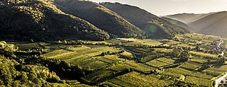
Poigen designates a relatively large continuous area under vine cultivation between Bacharnsdorf and Mitterarnsdorf. The name indicates a curve or a bend. It is unclear whether it refers to the Danube or the trench towards the Dunkelstein Forest.
Soil Profile Poigen
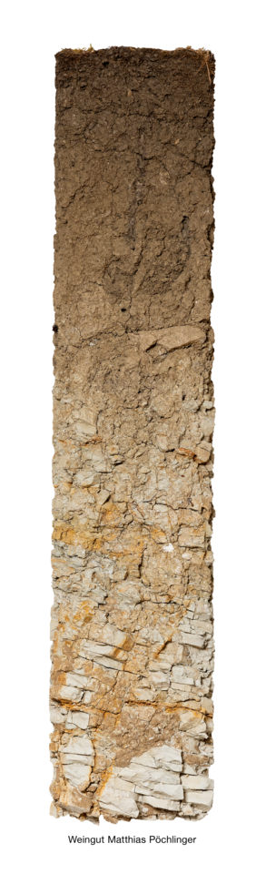
Sea sediments going back to the Langhian age (13–16 million years ago) have been conserved in the upper section of the Poigen vineyard. Seawater flooded the Wachau, leaving sand, gravel and marl behind. This brown-earth profile developed on a substrate of marl, a mixture of lime and clay. At right above the middle of the profile, a paragneiss fragment with rounded edges can be recognised. Erosion-related events transported it to the Poigen vineyard from Dunkelsteinerwald. This is a clear indication that silicate material from the Bohemian Massif also figures into the structure of the upper half of the profile.