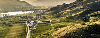
Hollerin
Facts:
- Town:
- Dürnstein
- Size in ha:
- 4,13
- Altitude in m:
- 206 - 253 m
- Aspect:
- S
- Average Slope in %:
- 15
- Max. Slope in %:
- 51
- Insolation in hours per year:
- 2185
- Terraced vineyard:
- Partially
- Distance to Danube in m:
- 517
- Labour required in h:
- 1.400
- First documentary evidence:
- 1477


Description
Hollerin designates the slope toe area between the Kellerberg and the Höhereck, and therefore represents the foothills of the Flickertal valley. The name is related to the presumably oldest designation for a vineyard in the Wachau region in 1019. "Dem hohlen Stein" (the hollow rock) likely refers to the area at the foot of the Höhereck, which, together with the Watstein vineyard, defined the town limits of Dürnstein.
Soil Profile Hollerin
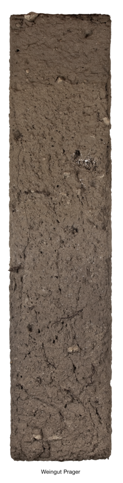
In the terrace vineyards of Hollerin, Gföhl gneiss represents the parent material for soil formation, while in the level vineyards at the footslopes, the vines are rooted in weathered and slightly decalcified loess that has been relocated. The Gföhl gneiss stones that are readily visible in the profile were mixed with the loess by erosion processes.