
Axpoint
Facts:
- Town:
- Spitz
- Subsites:
- Hochrain
- Size in ha:
- 12,80
- Altitude in m:
- 205 - 293
- Aspect:
- S
- Average Slope in %:
- 12
- Max. Slope in %:
- 52
- Insolation in hours per year:
- 2102
- Terraced vineyard:
- Partially
- Distance to Danube in m:
- 216
- Labour required in h:
- 4.500
- First documentary evidence:
- 1234


Description
Axspoint refers to the slope toe area and the level area between the vineyards Singerriedel and Pluris as well as the slopes of the Rotes Tor. The name was originally "Abtspoint" and provides information on the former ownership. It was first documented in 1243 as "Akspevnt".
Soil Profile Achspoint - Hochrain
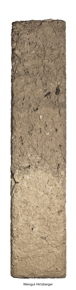
The Axpoint slope is located in the sheltered basin surrounding Spitz. Persistent westerlies during the last ice ages deposited thick layers of loess. Loess consists mainly of silt, soil of a grain-size fraction between coarse sand and fine clay, which can be easily transported by wind (silt: 0.063-0.002 mm). The mineral composition of loess is dominated by quartz, feldspars, micas, clay minerals and calcite (carbonate). Iron oxides give the loess a yellowish-brown colour.